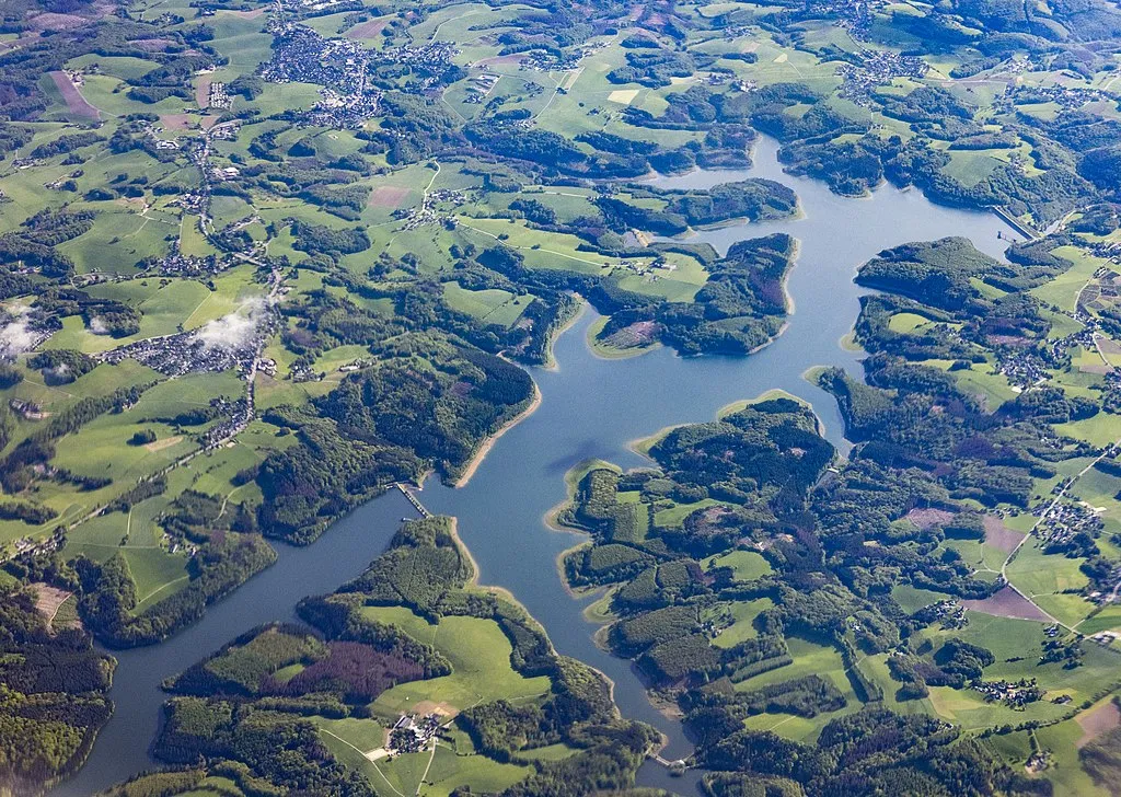
Große Dhünntalsperre
Meine Alarmaa!
Aktueller Füllstand: Pegel | Stauhöhe | Stauinhalt
Diagramm
Füllstand & Tendenz
Zeit
Wert
Tendenz
16.06.26 19:00
165.61 m ü. NN
+0.01
17.06.26 02:15
165.61 m ü. NHN
+0.01
17.06.26 02:15
39.17 Mio. m3
+0.02
17.06.26 02:15
48.36 % *
+0.03
Kategorien
- Ort
- Gewässer
- Nutzungsart
- Klassifizierung
Große Dhünntalsperre
Daten zur Stauanlage
Bauzeit
1975–1985
Kronenhöhe
63 m
Kronenlänge
400 m
Einzugsgebiet
60 km2
Stauseefläche (Vollstau)
4.4 km2
Stauraum (Vollstau)
81 Mio. m3
Höhenlage (Stauziel)
176.5 m ü. NN
Geo-Koordinaten
Quellen
- Füllstand [Mio. m3]
- Hochwasserportal des Wupperverbandes
- Füllstand [m ü. NN]
- Wupperverband - SensorWeb
- Füllstand [m ü. NHN]
- Hochwasserportal des Wupperverbandes
- Stammdaten
- Hochwasserportal des Wupperverbandes
- Beitragsbild
- https://upload.wikimedia.org/wikipedia/commons/thumb/9/90/Gro%C3%9Fe_Dh%C3%BCnntalsperre.jpg/1024px-Gro%C3%9Fe_Dh%C3%BCnntalsperre.jpg
- Wikipedia Artikel
- https://de.wikipedia.org/wiki/Gro%C3%9Fe_Dh%C3%BCnntalsperre
- Wikidata Item
- Q1548167


